
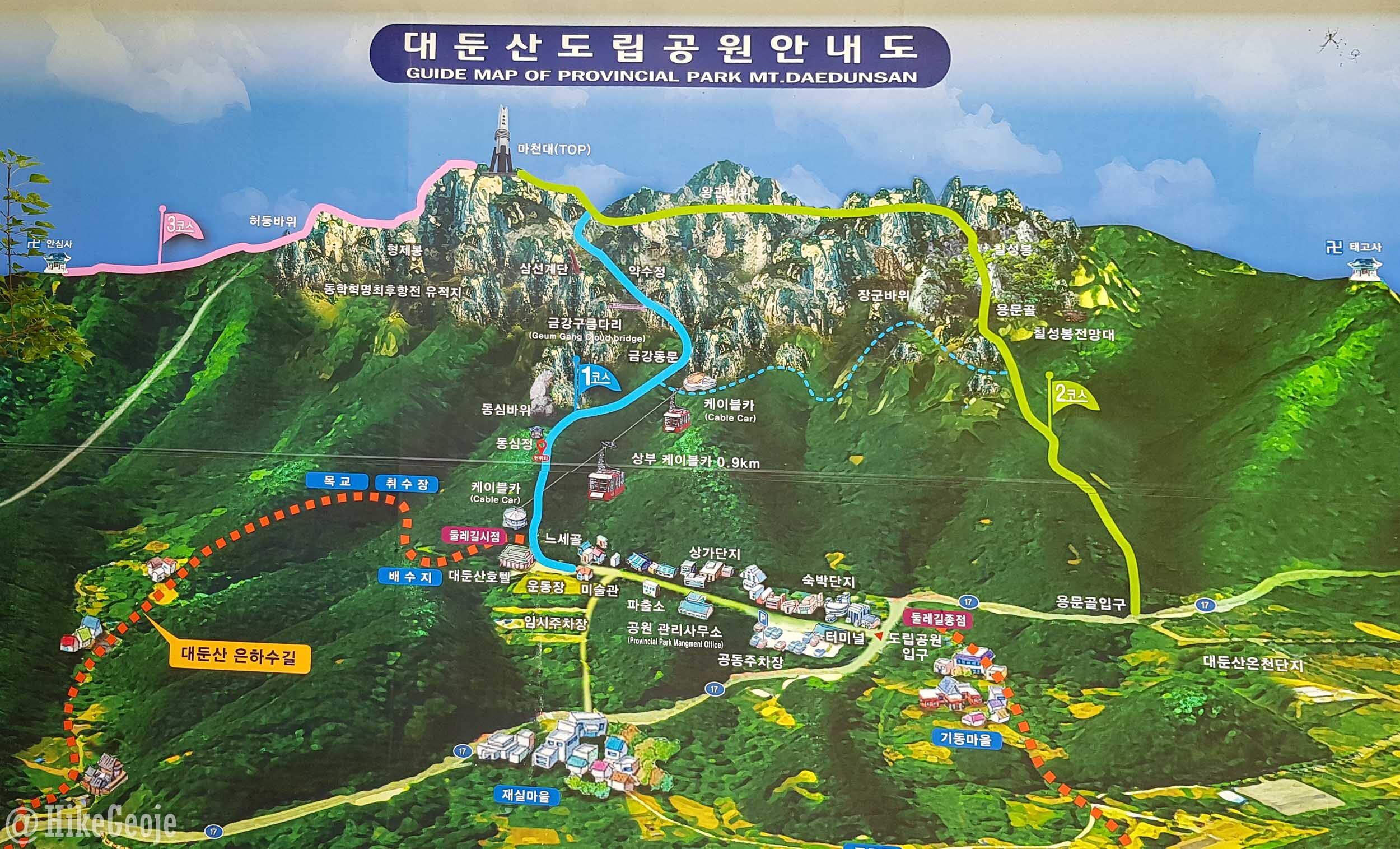
daedunsan provincial park 대둔산 도립공원
macheondae 마천대 878 meters
About 7.5km Round Trip
📍trailhead
I hiked Daedunsan on Sunday morning during a hiking trip, on which I had covered Gyeryongsan National Park on Saturday since they were reasonably close together.
Luckily, when I awoke at the hotel my legs were still feeling good after the previous day’s hike across Gyeryongsan, so I was good to go and didn’t have to resort to taking the cable car up Daedunsan, although there is that option.
*Sidenote: Although this mountain is quite beautiful at the top I wouldn’t bother hiking the entire thing again, instead I’d opt for the cable car. The highlights are the bridges and peak which you can easily reach with the cable car and then a short hike up. The rest of the hike was rather blah and I didn’t really enjoy it.
The trailhead starts at the same entrance as the cable car. My plan was to follow course 1 up (the blue course), then head over to the peak before turning back and following course 2 (marked in green). After hitting up the Chilseongbong Observatory Platform, I’d return on the dotted blue line and then make my way back down through course 1.
The trail up was quite steep and damp, but I knew it wasn’t really a long way to get to the top. The first point of interest was a small temple shrine.
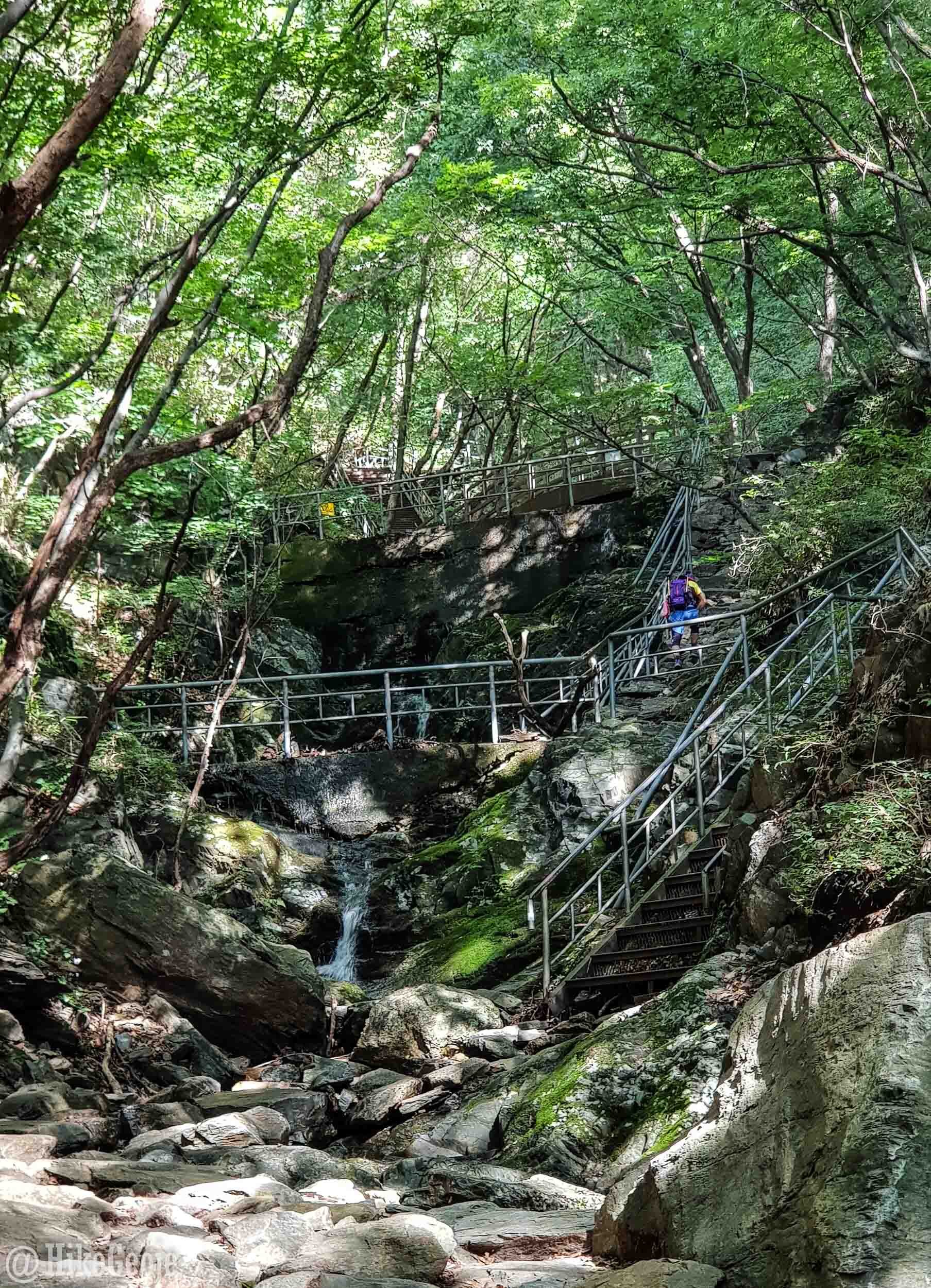

From here, the next stop along the way was Dong Sim Bawi, a huge rock that you can see through the trees. They say this rock attracted a Buddhist national priest back in the Silla Dynasty. Mesmerized by it, he hung out there for 3 days. I didn’t hang out for that long, but did pause long enough so that I met some other foreigners on the trail. They are both medical students from Uzbekistan: Tamara and Muzaffar. They were studying in nearby Daejeon and this was Tamara’s last weekend in Korea. Although she had been to Daedunsan a few times previously, she wanted to hike it rather than taking the cable car. As for Muzaffar, this marked his first hike…ever! We climbed up the large rock for some photos with Dong Sim Bawi perched well above us on the mountain behind.

After Muzaffar kindly shared some sort of salty Uzbek snack, we kept moving up the mountain. The next main stopping point was the turnoff to the cable-car or to continue on ahead to the bridges and peaks. I obviously wanted to keep going to the bridges, but after having completed the hike, I see that it makes more sense to head for the cable car and follow the route from there. It appears to be laid out a bit better if approached from that direction.
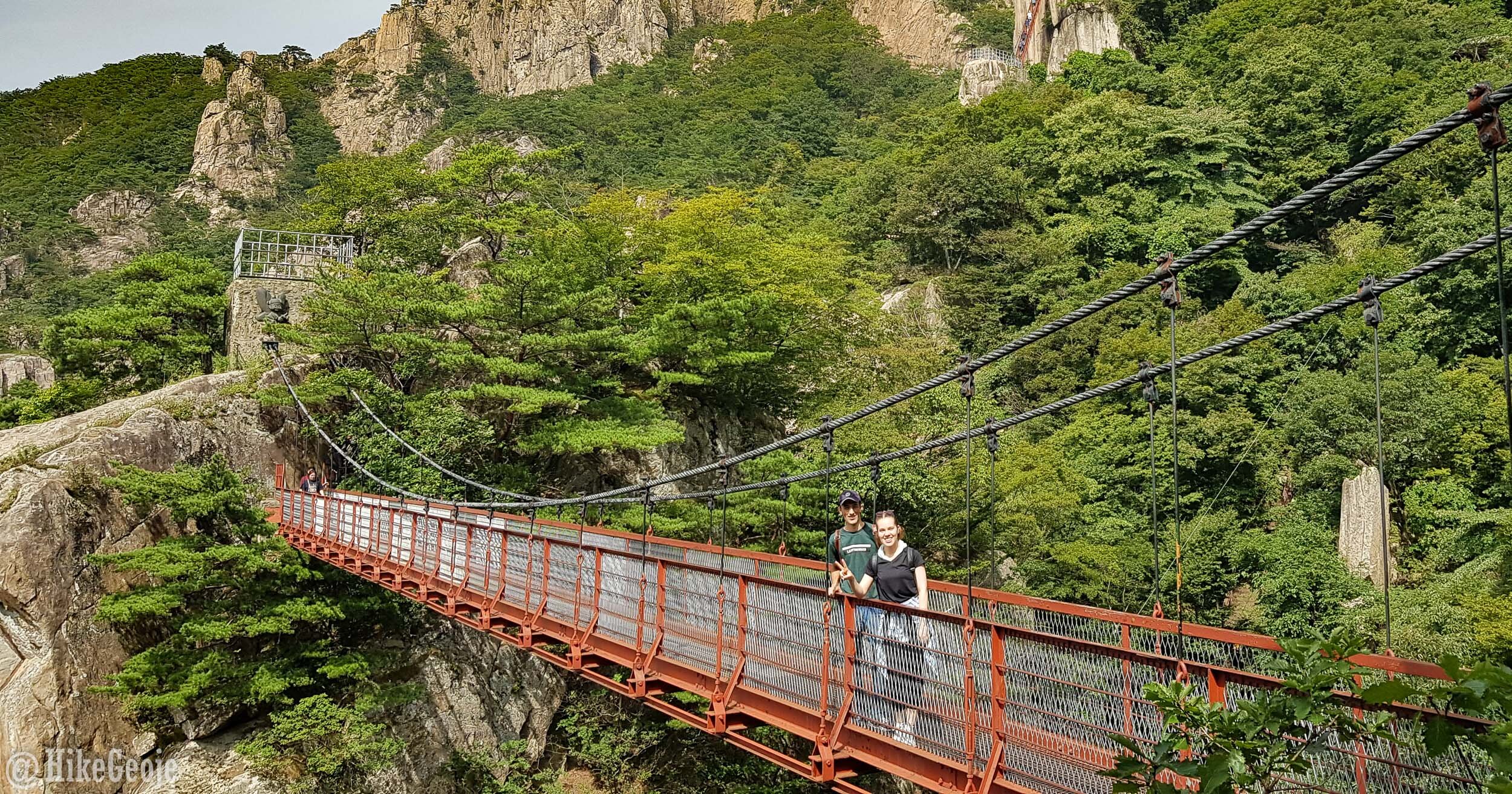
Whichever route you choose, from here on out it is beautiful! You get some pretty amazing views of the rocky ridge line, soon followed by the Geumgang Scenic Bridge (aka Cloud Bridge) and Samseon Stairway that Dadeunsan is best known for.


I felt fortunate to have visited Daedunsan at this time of year. It wasn’t nearly as busy as it appears to be from other pictures I’ve seen on the internet; mostly taken in fall. With a few minutes of waiting you can have the bridge all to yourself for some quick photos…thanks for being my photographer, Tamara! It was great hiking with Tamara and Muzaffar, but this is where we parted ways. However, we did meet again on the peak.

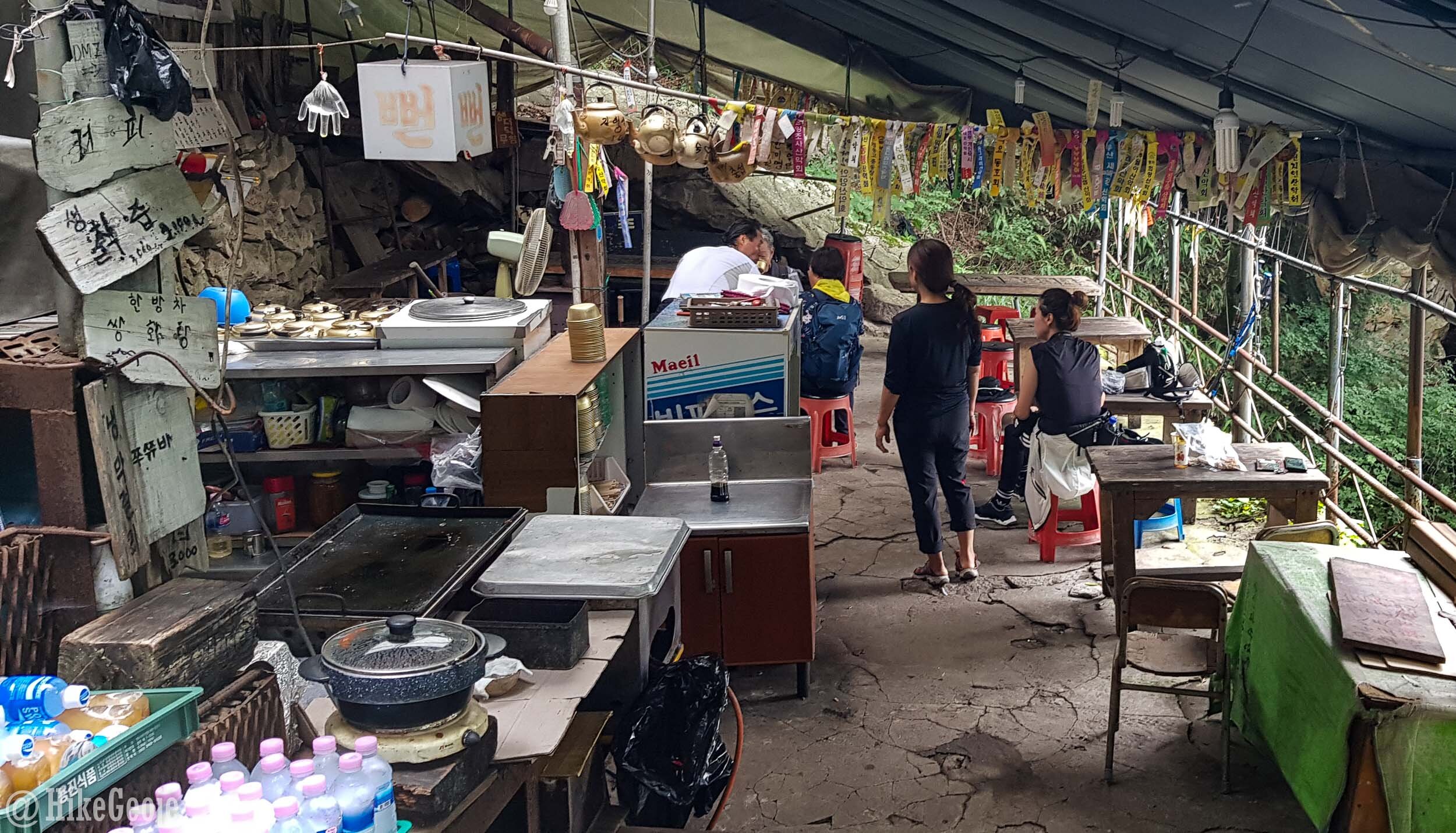
In the short distance between the Cloud Bridge and the Samseon Stairway is the Yaksujeong Rest Area. This has a small restaurant and lots of cold treats on hand if you need something refreshing. I was too eager to get to the stairway though so I snapped a few quick pics and forged ahead.

At the base of the stairway is a small platform area where you can look down at the Cloud Bridge and everything you have just climbed, as well as wait for the most opportune time to climb the stairs. The stairs definitely felt a bit scary going up, but not so scary that I didn’t take a selfie or two along the way. A kind stranger at the top of the stairs offered to take my pic and this ended up being the best of the bunch, so I was thankful for her offering.


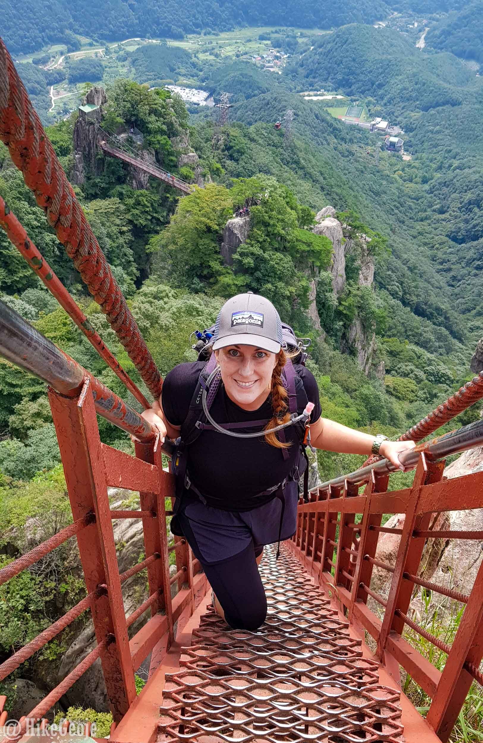
Once you have conquered the stairs it’s not too far to go to reach the peak of this mountain, Macheondae. Once again there are some beautiful views from here along with the strangest rocket-ship summit stone I’ve ever encountered. Relax on the rocks behind the “rocket” and take in the view before getting back on course.

Yep, this is the summit marker!

Heading back the way I came I continued on straight for 450m to the Yongmungol 3-way junction (용문골삼거리). From the maps, it appears that this part of the trail is along the ridgeline, so I was quite disappointed to find that instead it travels behind the ridge, but there are a few off-shoots that allow you to safely go up and take a look along the way.

Eventually you’ll reach the 3 way junction and you can hang a right headed towards Yongmun Cave (용문골) and then Chilseongbong Observatory Platform (칠성봉전망대). When you emerge near the large sign for the cave it is hard to tell where exactly the cave is. I don’t think I actually saw it unless they considered the walkway between the large rocks on the way to the observatory platform the “cave”. I am known for being oblivious at times, but there was a group of Korean hikers who couldn’t seem to figure it out either.
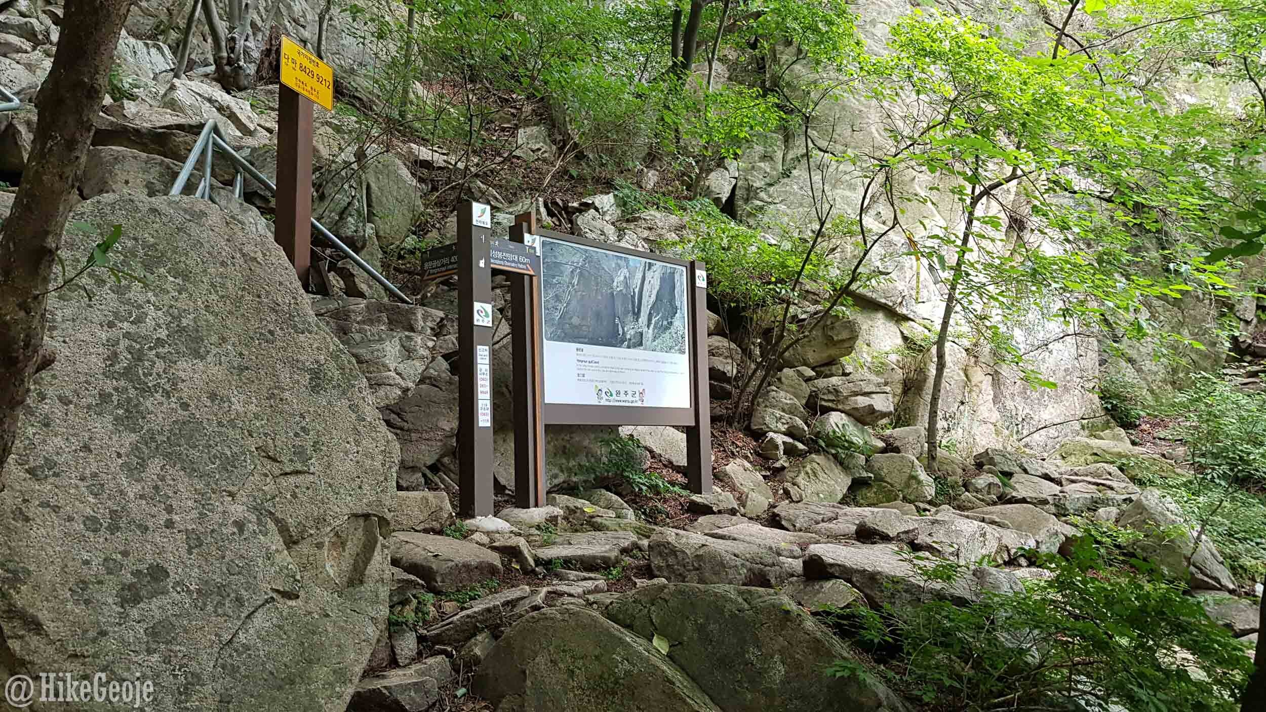
Follow the sign pointing in the direction of the observatory platform. It’s only 60meters from there. You will see some ropes for climbing up some boulders. I contemplated climbing them to see what was up there but I was hiking alone and with my track record of hiking accidents in the past year I opted not to give it a go. A group of hiking men went up though and quickly came back down so I’m not sure if it is worth trying.

These guys are making this look much easier than it actually was.

Could this be the “cave”?
Once you make it to the platform you’ll get your last bit of views of the rocky mountain. The views weren’t as spectacular as they were at the peak, but it was still pretty. From here you will head back to the previous turnoff with the cave sign and start in the direction of the cable car which will be down the hill and then to the right. There are times that the path is quite rocky and it’s hard to follow, but if I could find my way back I’m sure anyone could.

Chilseongbong Observatory Platform
Overall, I absolutely loved the bridge, stairway, and Macheondae peak but was a bit disappointed in the rest of the hike. I’ll definitely return again, but will only be taking the cable car to see the highlights.