
gyeryongsan national park 계룡산 국립공원
sambulbong 삼불봉 775meters
Gwaneumbong 관음봉 776meters
9.2km loop
📍trailhead
I set out on a solo hiking weekend to tackle both Gyeryongsan National Park and Daedunsan Provincial Park since they are both about a 3 hour drive from here in Geoje. Let me start by saying Gyeryongsan was so surprisingly beautiful that I’m already planning a trip back up this way again once it gets a little cooler so Andrew can experience it with me.

Starting at the trailhead you will find all of the usual park restaurants and shops that every national park welcomes you with. I did a bit of research before going to find the best route to take and I settled on a 9.2km loop as shown in the picture below. I’m so happy I went with this route because it felt like the climb up was more enjoyable than steep, and best of all, the mountain slowly revealed it’s beauty to me. I’d rather see a bit at a time culminating in the grand finale.

Follow the green outline starting and ending in the right hand corner.

Turn right here.
As I said, taking this route up was quite enjoyable. It was a rocky path, but the rocks were flattened into the ground mostly, so it’s not the kind of terrain that is super hard on the knees. The first junction that you will come across is the Mungol Intersection 문골삼거리. Don’t bother sitting for a long rest here though, as there will be much better spots for a rest further on. Continue on straight as the path starts to slope downwards for a short ways.

The terrain starting out.

Mungol Intersection
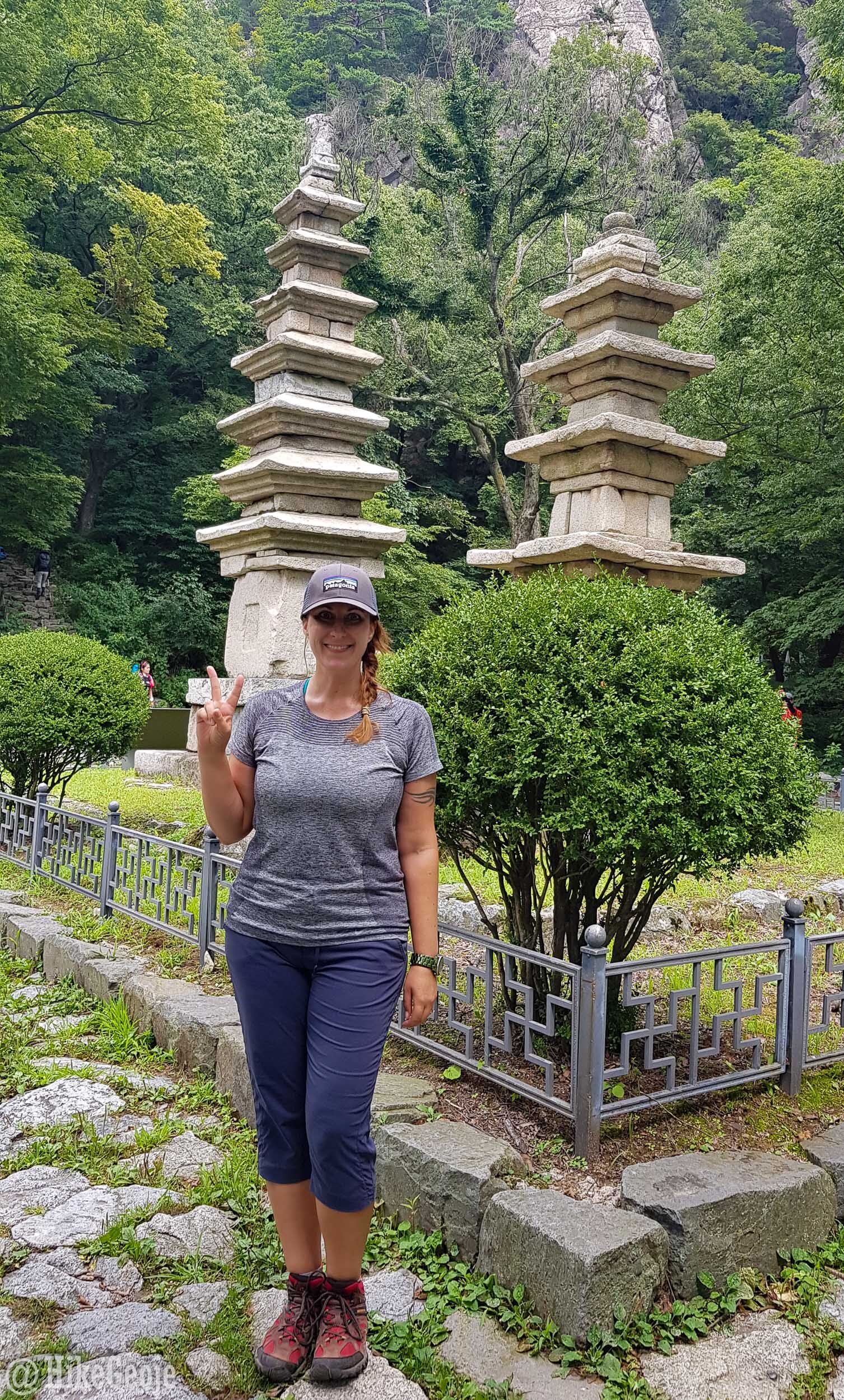
Keep heading in the direction of Nammaetap Pagodas 남매탑. These twin pagodas have a story to go along with them about a monk who was practicing asceticism in a cave. If you’re like me, and don’t know what that means: according to Webster-Merriam it’s “strict self-denial”. So the story goes that a tiger came along and roared at the monk, at which point he spotted a thorn in the tiger’s throat so he pulled it out. After that the tiger brought a pretty lady on its back as a way to say thanks. It turned out it was the night before her wedding and although the monk tried to give her the boot, he allowed her to stay since it was snowing. After that, her parents said she should marry the monk since she couldn’t marry the other guy after having spent the night with the monk. He wasn’t down with that, so they decided to have a brother-sister relationship and practice Buddhism together. So the twin pagodas here are known as the brother and sister pagodas.


Continue over the hill, and you will see Sangwonam 상원암 temple/hermitage and several long wooden tables overlooking the valley below. It is here that the pink rocky landscape will be visible for the first time since you started hiking. This is a great spot to stop and have a snack.


Continue hiking for only 0.5km until you reach the first peak: Sambulbong! Along the way, you’ll come to another intersection, stay to the left and follow the signs for Sambulbong 삼불봉. It’ll get much steeper as you approach the peak and you’ll be walking up lots of metal stairs. The view at the top is incredible though and well worth the effort!


Looking at the ridge line from Sambulbong, you’ll see what you still have to cover before making your way off the mountain. You’ll also see Cheonhwangbong Peak, which stands at 845.1 meters. This peak is technically the highest in the park, but it is off-limits because it is part of a “military installation protection zone”.

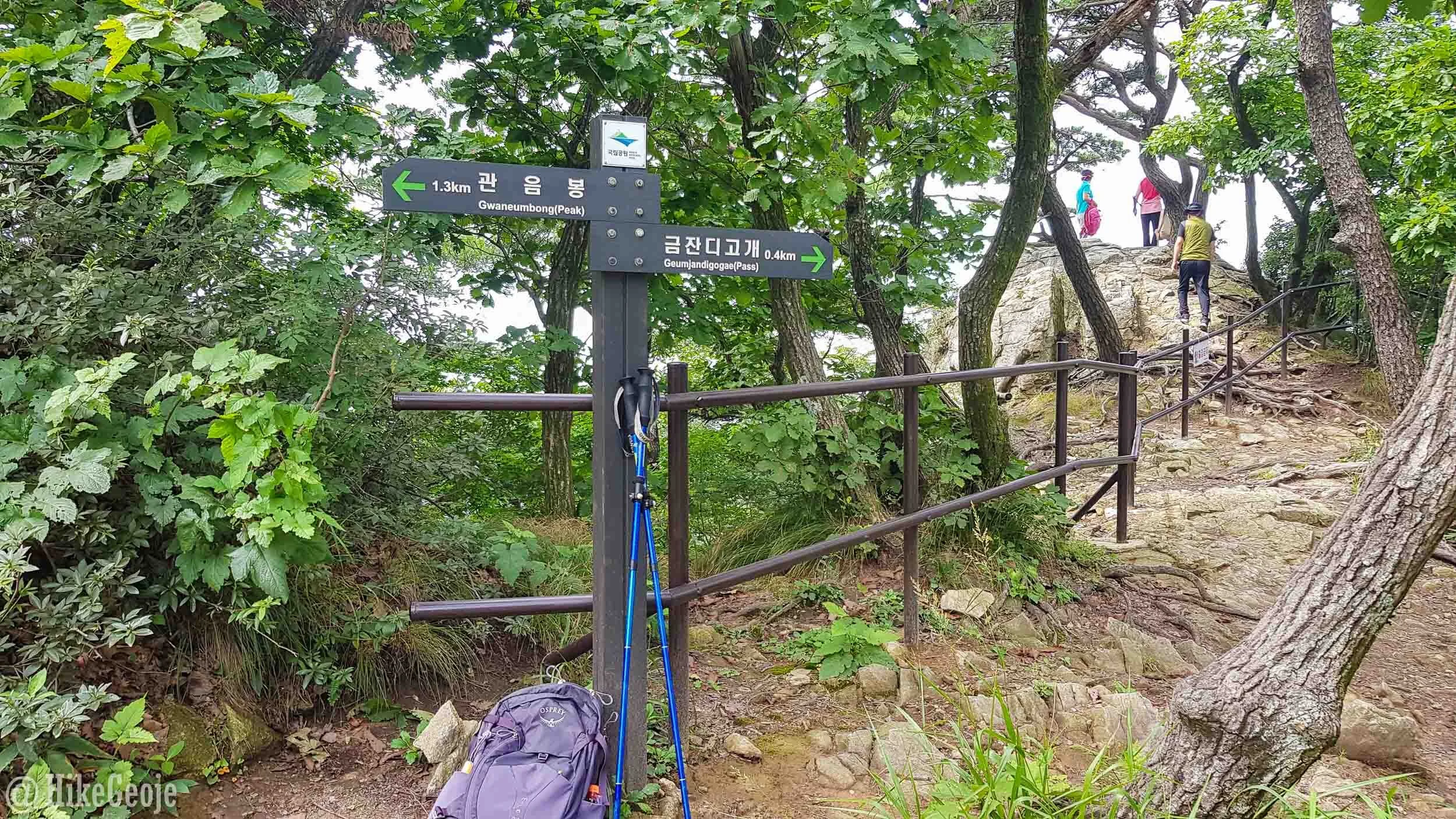
Before you reach the rocky ridge line, you’ll have another junction in which you’ll turn left, just follow the signs for Gwaneumbong 관음봉. However, there is a nice look-out if you climb over the fence at this junction. Not that I would ever recommend doing something you’re not supposed to be doing. but…
Turn left here…but where are those people going?

A pretty view on the other side of the mountain.
The views are spectacular along the ridge line! You’ll see Donghaksa Temple 동학사 nestled in the forest well below the mountain. This temple is where the trail eventually ends and you begin the walk back to the entrance.


Can you spot the temple down there?


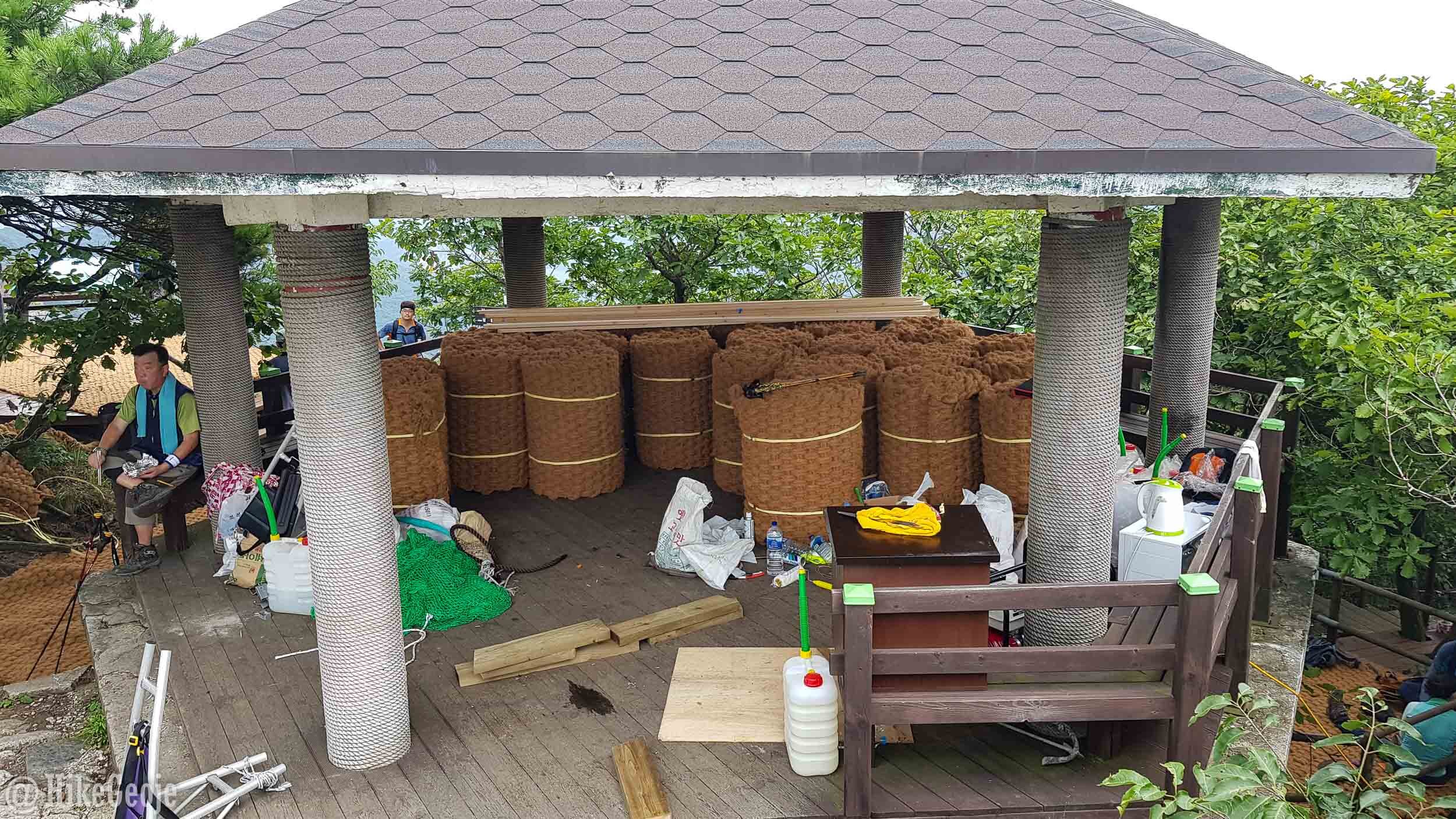
You’ll have one more big set of stairs to climb to reach the final peak of Gwaneumbong. At the top there is a wooden gazebo along with the standard summit stone. This peak is a bit different though as there were lots of wooden platforms attached to the wooden walkway on the way down that were filled with people having their mountaintop lunch.

During my visit, the smell of fresh paint was in the air and there were several “bails” in the wooden gazebo of the jute-like fabric that carpet so many trails. The workers at the top had their work cut out for them.
At this point, you’ll start to make your way off of the mountain. The trail from here is quite steep and rocky, but the steepest part is only about 1 kilometer long. Next, you’ll reach Eunseon Waterfalls. When I visited they weren’t terribly amazing as there wasn’t a tonne of water running over them, but at 46 meters high, I bet they’re beautiful after a heavy rain. Very soon after the waterfalls, the trail levels out a bit until you reach the temple.

Eunseon Waterfalls

Nearing the end.
You’ll emerge from the trail and arrive at Sangwonam Hermitage grouped with Donghaksa Temple. Take a look around the temple grounds before following the roadway for 1.2 kilometers back to the park entrance.

Once back to where you started, if you’re looking for a post-hike meal, you’ll have a large choice of restaurants. I settled on the “stream restaurant”. This restaurant is on the right hand corner where you first turned to start the hike. Head on inside, order and pay then cross the street to the stream and choose a mat. They’ll bring the food out to you so you can enjoy it in nature. So yummy, too!


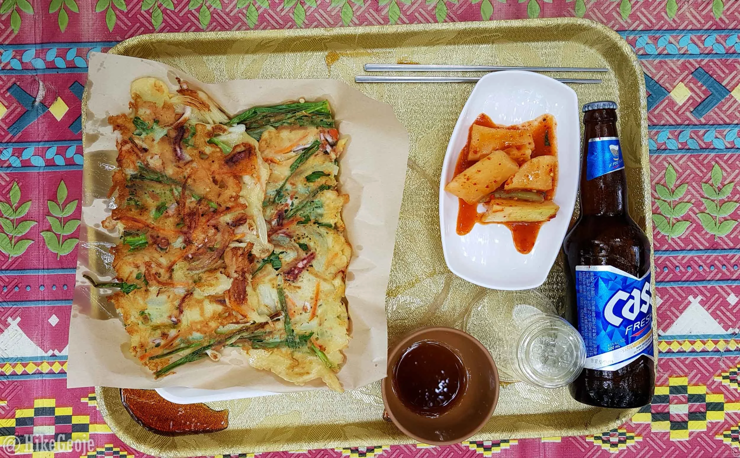
Yum!
Finally, if you’re looking for a place to stay close to the mountain, I stayed at S무인텔 . At just 40,000 for a Saturday night, this place was a steal! There are several other hotels in the area though so take your pick!
Be sure to check back next week for the next day of the hiking trip: Daedunsan. Coupling these two hikes together made for a great weekend!