
MANGCHISAN 망치산
361.8 meters
1.3km to the peak
📍trailhead
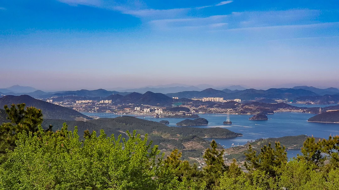
Mangchisan is on the western side of the island heading towards Tongyeong. It’s a relatively short hike, but offers some great views of Gajodo, as well as Tongyeong.
If you have your own transportation, or are taking the bus, park/get off near Seongpo Middle School, before walking down the hill and crossing under the highway. This is where the trailhead begins.
It was very easy to follow starting out, simply walk up the narrow concrete road passing a few houses along the way. Follow the trail, and soon enough, you’ll emerge at a dirt road where you can go right or left. Turning right will take you to private property, so you have to go left.
Right this way!

Do not enter here, this is private property.
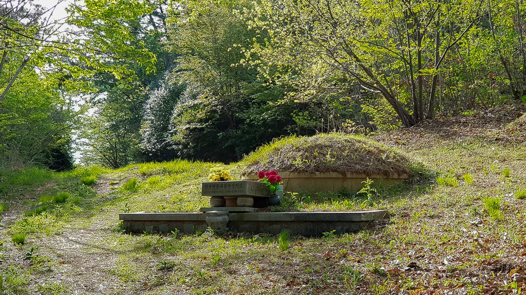
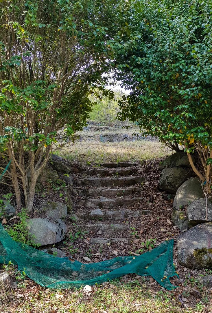
Go to the left past this burial mound.
Pass the first burial mound and you will find some rocky stairs leading to more burial mounds, go up these stairs. From here, I had difficulty finding the trail, but I knew it was there so I walked through all of the other older burial mounds, and saw what looked like a (very) overgrown ATV trail to my left. I followed this for a very short time and suddenly the trail was on the left of the overgrown ATV track. From here on out, it’s very easy to follow.
There is one more junction on the way to the peak. You will reach two paths, the one on the left has stone pagodas framing the entrance...go that way.
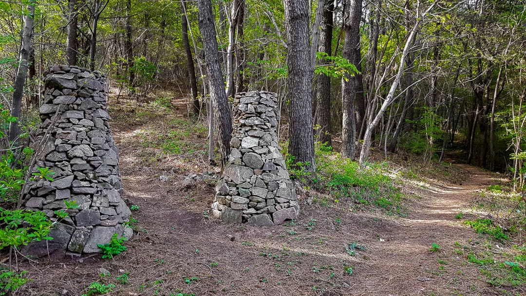
Go left left here.
This is not a long hike, but it’s a little steep, so take your time, the views at the top are well worth it.
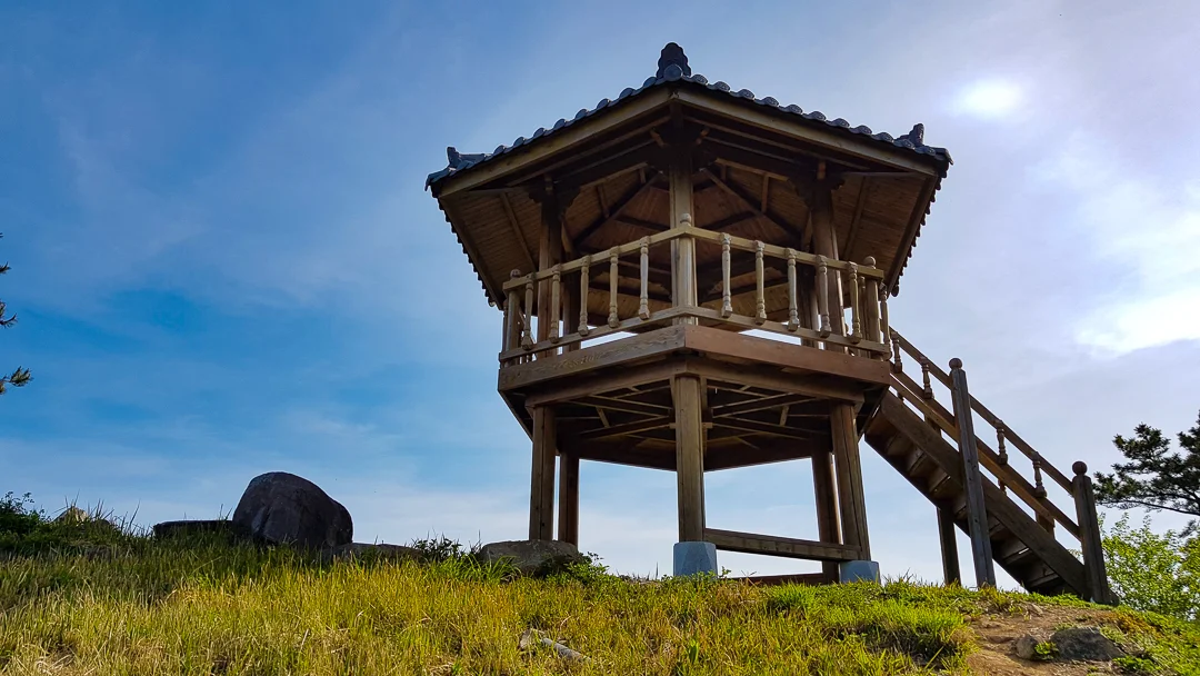
Perched on the peak is a beautiful gazebo that has a great view of Gajodo looking north, and Tongyeong looking west.


If you brought your own car, you’ll definitely want to backtrack to where you started because it was a bit of a pain trying to get back to the car at the end of the hike.
If you are using public transportation or aren’t in a hurry and don’t mind walking back through roadways, then keep going.
In just a short distance you will reach Mangbongsan and can choose to continue hiking to Daeri Village (대리마을) for 1km or Jiseok-gogae (Pass) (지석고개) for 1.5km. I opted to follow the trail to Daeri Village so I wouldn’t have as far to walk to get back to my car. Following this trail is easy, and soon you will emerge at the other trailhead for Mangchisan here.


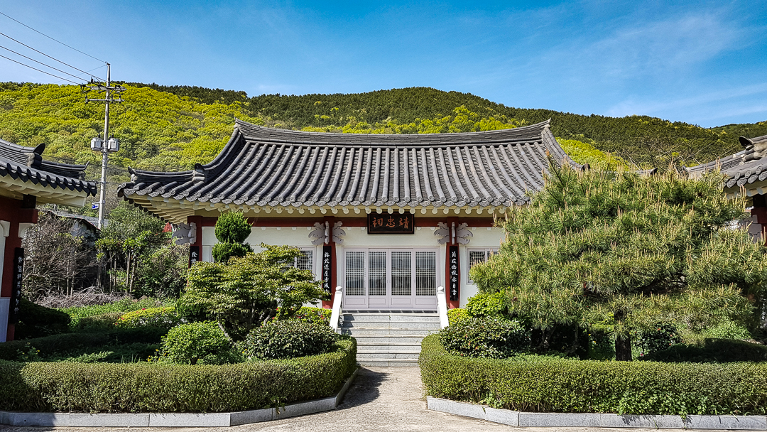
A pretty building I saw in Daeri Village, on my walk back to the car.
Walking back to the car was a little difficult as I had to cross under the main highway, walk alongside it for a very short time, then finally walk through the neighborhood by “Kun Hwa Industries”.