
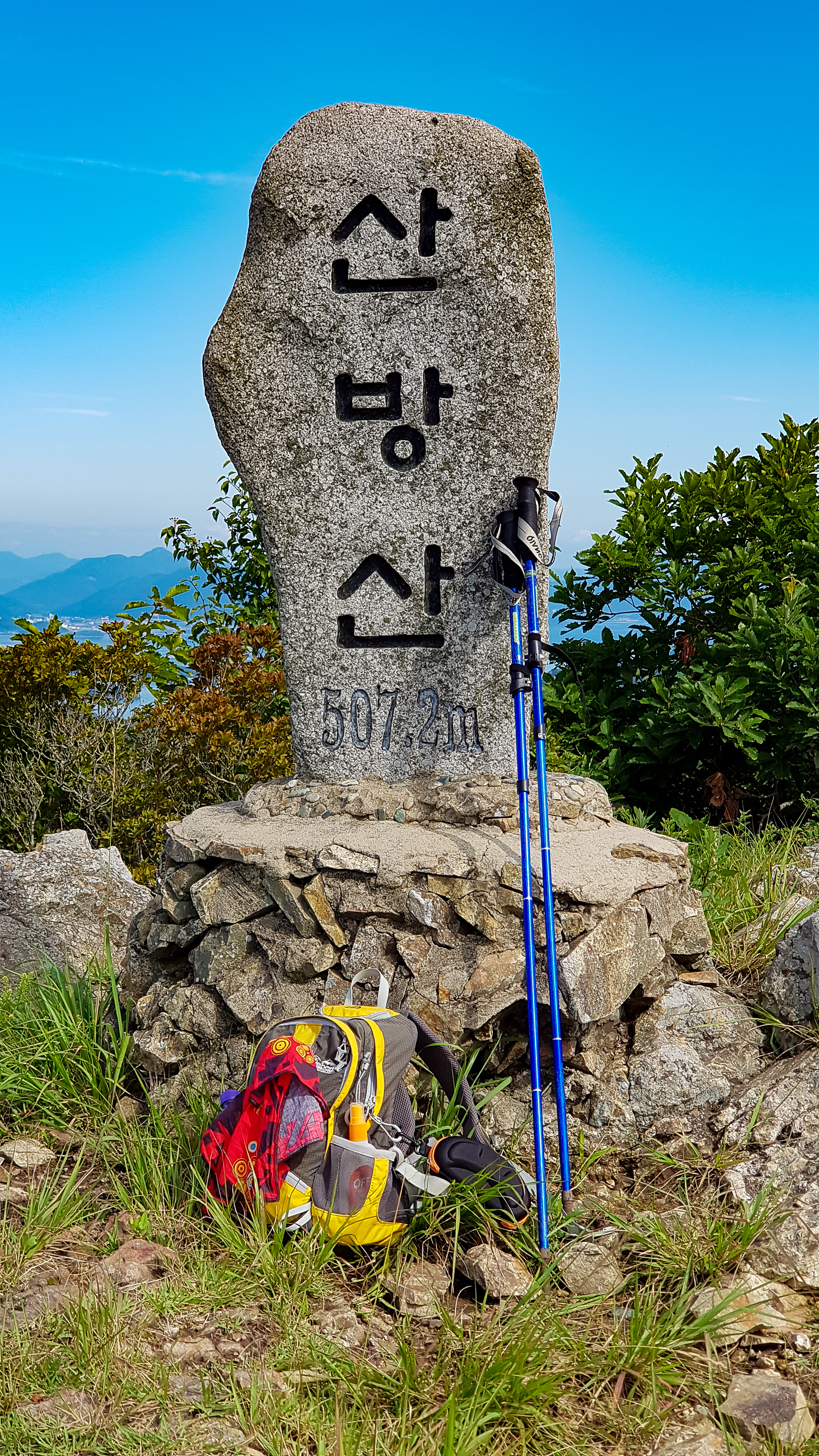
Sanbangsan 산방산
507.2 meters
1.8km return
📍trailhead
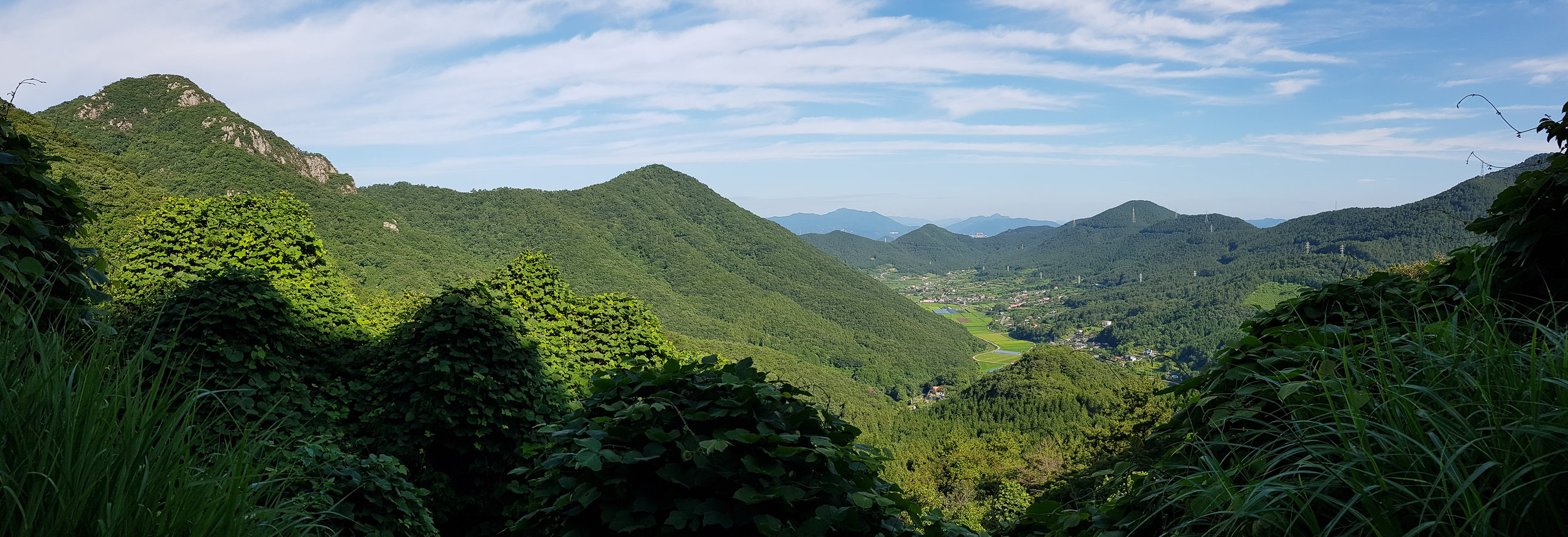
Sanbangsan is another breathtaking mountain in Geoje's repertoire of natural beauty. Looking out over western Geoje, you'll enjoy a 360° view from the top.
The trailhead starts near Sanbangsan Biwon (aka Secret Garden). Just a little further up the road from here you will see a place to park almost across the street from the start. (If you’re looking for an easier way to reach the peak of this mountain, check out the first alternate route, newly listed below).
About halfway up the mountain, you'll emerge at a rocky outcrop offering you your first views looking back over Dundeok-myeon. This is a great spot to take a little rest before continuing the climb upwards.
Nearing the top, you will come across 심신굴/부처굴 (Grandmother's cave/Buddha's cave.) 심신 is a traditional word for a grandmother who you can pray to for fertility.
Enjoy your time taking in the panoramic views from the summit before returning the way you came or exploring connecting trails on the mountain. Congratulations on crossing another one off of the list!
Alternate Routes
Since this original blogpost I’ve had the chance to hike one of the alternate routes mentioned. This route is actually much easier than from the main trailhead above...so easy that I’ve done it twice in as many weeks.
To try the alternate route, start at this trailhead instead. If you are driving, you can drive onto the mountain access road for a very short distance before pulling over to the side and parking.

Much of this hike follows the mountain access road and is fairy flat starting out. There will be a steeper climb eventually, but the periodic views looking towards the peak of Sanbangsan and the village of Sangdun-ri will keep a spring in your step.

You’re likely to see plenty of goats as there is a goat farm on this road, along with an abandoned bee farm. I started hiking pretty early so I saw at least 100 goats behind the fence along the road), but on my way back, the goat farmers had arrived and I saw less goats but they were roaming free at this point.
After about 2.3km of walking on the access road, you’ll come to an old wooden gazebo and across from it you can enter the woods to follow the trail to the peak. This trail is only .65km, so it will be fast going. It gets steeper at the end where you climb up to the rocky peak.


Nearing the top, there is a large wooden platform with some pretty amazing views. Only a few more steps and you’ll reach the summit stone and be wowed with the phenomenal 360 degree views.


A few more steps from the other side of the summit stone there is also a wooden gazebo, a perfect spot for a picnic!


I gotta say, I love hiking, but can still be a bit lazy at times when it comes to steep trails (especially in the heat of summer). I really recommend this alternative trail if you don’t care so much about having to “work for it”. This is such a beautiful mountain and seems to be less traveled than a lot of Geoje’s other peaks, but I’m sure after you visit it once it’ll become a new favorite like it has for me!
You can also start near Jeong-insa Temple and travel 1.3km to the peak by following the trail starting at this trailhead.