
sandaldo 산달도
Danggoljaesan 당골재산 235meters
dwitsan 뒷산 214.1meters
geonneojaesan 건너재산 209meters
3.4km thru-hike
📍trailhead
Sandaldo has been on my radar since first moving to Geoje in 2015. It was always a hike that I put off due to the “hassle” of having to take the ferry there, but since the bridge has been open since earlier this year, I couldn’t put it off any longer, and I’m so glad I haven’t!
Sandaldo is a small island with three separate peaks and some pretty views of the surrounding islands along the way. I chose to hike courses 1, 2, and 3 as shown in the sign below, followed by a walk around the island back to my car, taking me 6.4 kilometers in total.

Starting at the trailhead, follow the narrow cement roadway before making a left onto the grassy road. Before long, you’ll reach a trail post. Turn right to head into the forest. At this time, it’s a bit grown over with leaves, but once you reach the treeline, the trail is well maintained and easy to follow.

The first views of Sandaldo.

The trailhead.
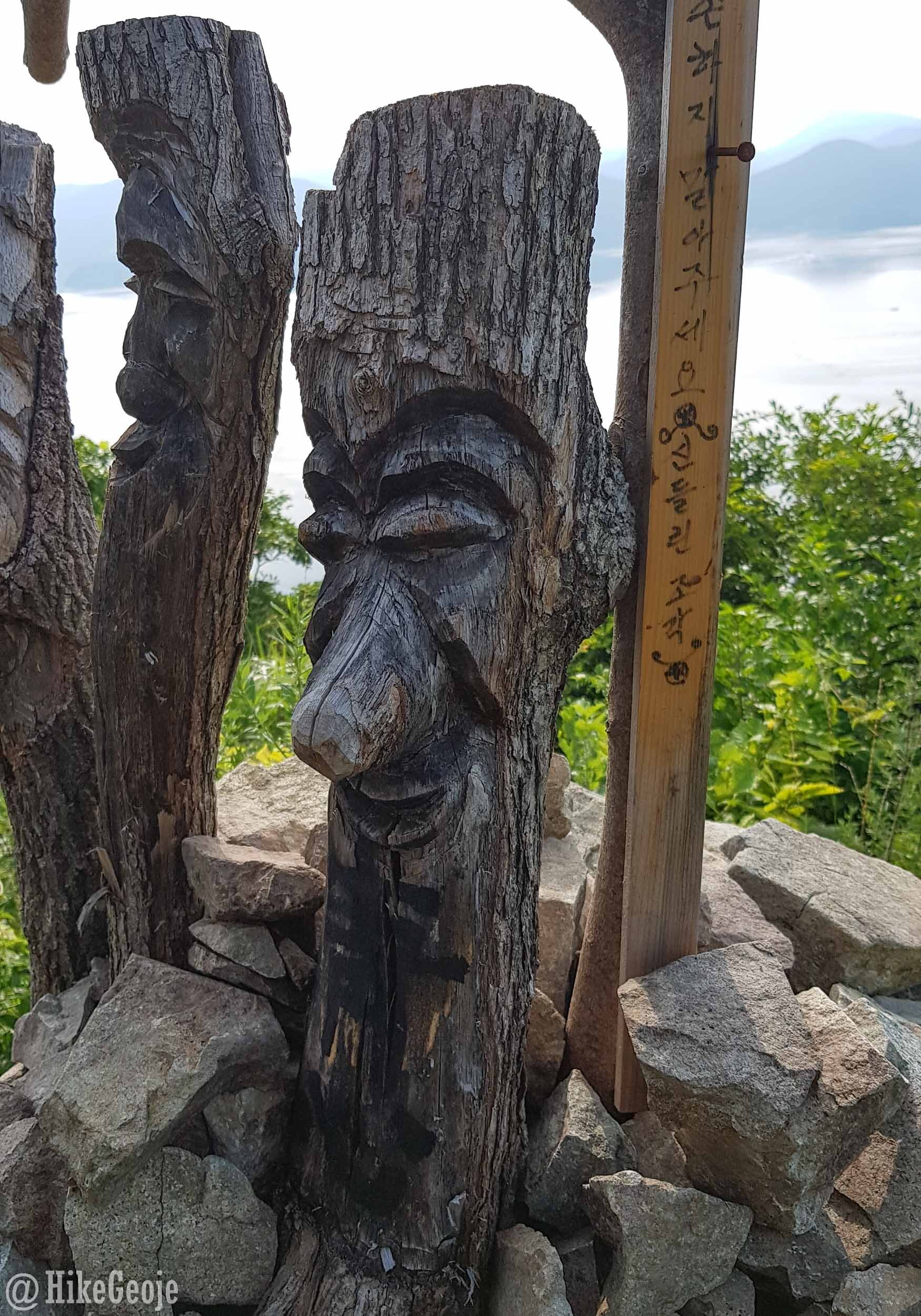
The first peak is approximately 1 kilometer from the start and takes less than 30 minutes to reach. It’s a bit of a steep climb but there are stairs along the way, and it’s not far to go. Arriving at the peak of the first mountain, Danggoljaesan, you’ll be greeted with a bench, a “homemade” summit marker sign, and a really neat sculpture of wooden masks and carved wooden birds. Oh!…and some pretty amazing views!


After you get your fill of the views at Danggoljaesan, follow the trail to get to the next peak. The trail down is very steep, but there will be lots of wooden stairs along the way. Eventually, it’ll flatten out and you’ll get a view of your next mountain, Dwitsan. Soon, you’ll emerge onto a paved road. You should be able to see then trail pick up again a little to the left across the road. Then you’ll start to climb again.

Lots of trail markers to guide the way.


That’s Dwitsan on the left.


Another homemade trail marker at the peak of Dwitsan. One more to go!
Continuing on from Dwitsan to the final mountain on Sandaldo, you’ll reach a 4 way junction after walking 425 meters. You can turn right or left to head into different vilages on either side of the island, but don’t stop now! You still have one more mountain to climb. Keep straight for another steep climb; just 265 meters to reach the peak of Geonneojaesan!

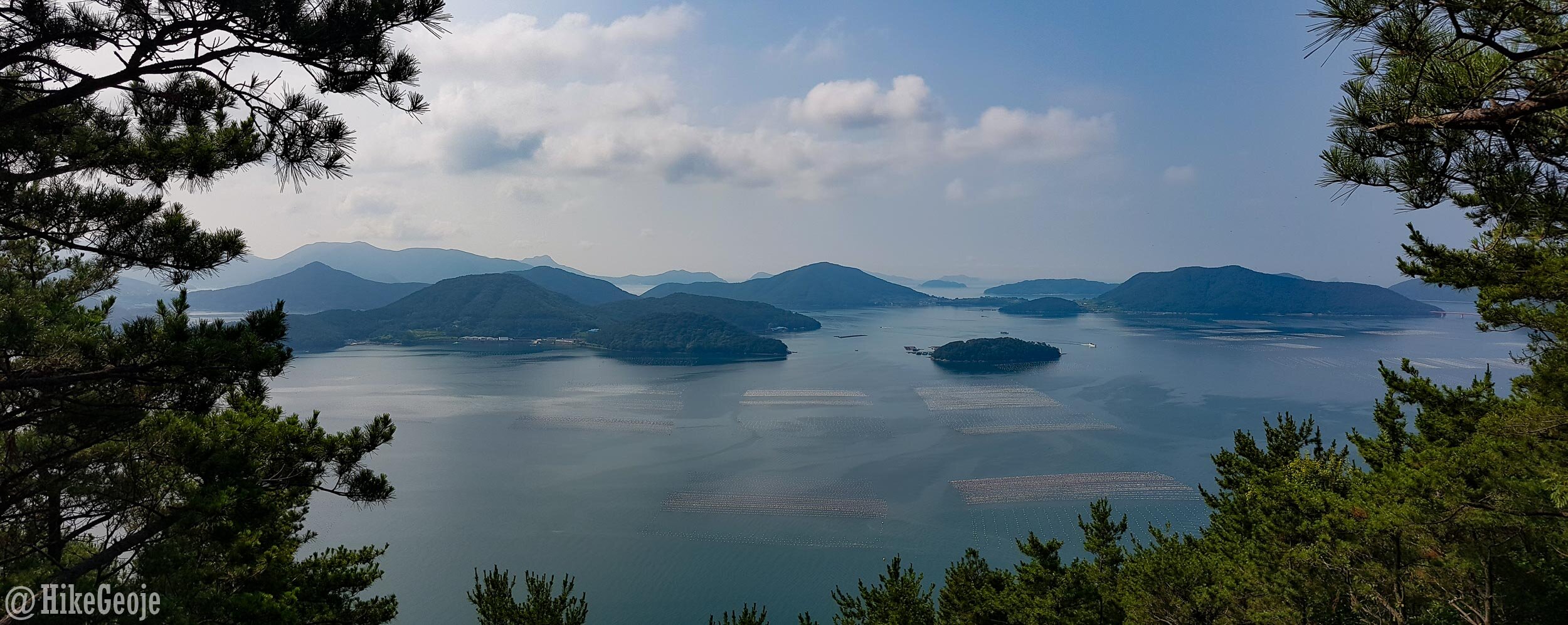
As you emerge onto the final crest of Geonneojaesan, you’ll see a large wooden platform with some fantastic views of neighboring islands. This looks like a perfect spot for setting up a tent and camping overnight.

The last peak marker is to the right. Continue along this trail for less than 1km to reach the roadway.

When a trail isn’t a loop, I usually opt to backtrack so I can spend as much time in the woods as possible, however, I chose to hang a right and walk around this little island to return to my car. I’m happy I did. This island is best known for its oyster industry, and oyster shells (like in the cover pic) lined the roadway in so many places.


There were also murals everywhere, making it such a pretty little village to walk through. Unfortunately, this was a weekday morning for me so I had to get ready for work, but I’ll definitely be back and hope to spend some time in the village and maybe try out some of the seafood on my next visit.


