
Wangjosan 왕조산
413.6 meters
1.2km to the peak
📍trailhead
Wangjosan has been on my radar for quite some time, but I’ve always put it off because I heard about a friend’s (Alex Barnett, another avid hiker) encounters with boars on this mountain.
However, it has been on my list for about a year so I finally decided to hike it along with my usual hiking sidekick, Ashleigh. Parked at the trailhead you will see a map with several different routes to choose from. We chose to follow the path going straight to the peak, turning right, and then heading back on the utility road. Unfortunately time didn’t permit us to travel the extra distance to reach the coast.
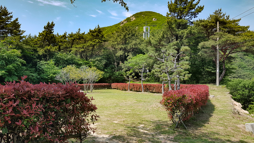
The trailhead starts behind the hedge (near a small tower) in the center of the photo.

The beginning of the trail was a little hidden. It’s in the middle, behind the red bushes pictured above. As we made our way up the mountain, there were some truly outstanding views. There are several rocky outcrops with views:
looking back towards the road and Garasan on the opposite side,
to the right overlooking the rice fields in the community of Nambu-myeon,
and to sandy Myeongsa beach to the left.


Each outcrop offered better and better views and lots of oohing and ahhing. I was so pleasantly surprised with how nice this hike was. Eventually, the trail turned quite grassy and seemed almost like an “elvish forest” by Ashleigh’s description.

However, this was where we saw a relatively fresh pile of wild boar poo. This was the first pile that we saw, but we would come across three more piles during our hike.

Uh oh…wild boar poo

It didn’t take long to reach the peak with the yellow summit marker. If I were to do this hike again, I would return back the way I came from this point. However, we continued on straight for 0.5km before turning right at the next intersection. From here we had 1.2km to hike before reaching the utility road and walking back 2.89km.

We were quite nervous hiking the stretch between the summit sign and the utility road. This is the stretch where we saw most of the wild boar poo, and it just “felt” like a place where we would see some boars. So we hurried along trying to make lots of noise and just get that section over with. This section of the trail wasn’t very pretty.

All in all, I’d still really recommend this hike for the great views, but only the portion of the trail to the peak and back. If you’re wanting to decrease the chance of bumping into wild boars, remember not to hike after dark, or near dawn or dusk.

Alex Barnett Vlog
Alex Barnett is a friend of mine and another avid hiker. You can check out his video series on some of these mountains as well.